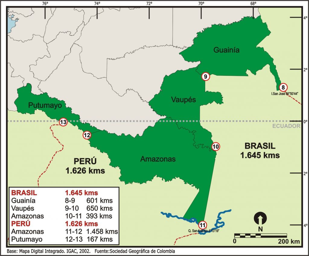
FRONTERA CON BRASIL Y PERÚ
Extensión total de la frontera: 3.269 km
Con Brasil: 1.644 km
Con Perú: 1.625 km
Departamentos limítrofes:
Con Brasil:
Guainía:
municipios limítrofes: Inírida; extensión: 601 km
Vaupés:
municipios limítrofes: Mitú, Taraira; extensión: 650 km
Amazonas:
municipios limítrofes: Leticia; extensión: 393 km
Con Perú:
Amazonas:
municipios limítrofes: Leticia, Puerto Nariño; extensión: 1.458 km
Putumayo:
municipios limítrofes: Puerto Leguízamo; extensión: 167 km
Post Views: 8


